
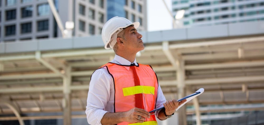
Certified Surveyor
Get in touchAt Certified Surveyors, we provide accredited measurement and asset assessment solutions and across the UK. Our service focuses on delivering precise spatial data and structural condition reports to support complex construction and property transactions.
By delivering expert technical oversight, our certified surveyor helps you establish a verifiable foundation for your development, ensuring that all project designs reflect the physical reality of the site.
When Do Sites Require A Certified Surveyor?
Identifying terrain risks and structural liabilities through a certified surveyor is a mandatory requirement for any development involving ground disturbance or structural foundations. We frequently operate on high-traffic highway developments and urban regeneration projects where level accuracy is safety-critical.
In residential sectors, these inspections are vital for verifying boundary positions and foundation depths. By providing this professional oversight, the survey prevents expensive design rework and ensures that your construction team avoids unforeseen site-based hazards.
At What Stage Should You Book A Certified Surveyor?
You should engage the services of a certified surveyor during the early feasibility or pre-design phase to ensure buried risks are factored into the project budget. Getting this data early identifies significant engineering bottlenecks, which prevents the need for redesigning layouts after construction has already started.
It is also essential to use these services following major site alterations to update master records. Proactive surveying mitigates the risk of fatalities and ensures the build remains compliant with national health and safety standards.
Which Specific Provisions Does A Certified Surveyor Offer?
Engaging a certified surveyor provides a modular toolkit of technical investigative tasks designed to yield an exhaustive record of your land and structures:
Topographical Site Mapping – Recording ground levels, contours, and existing structures to inform civil design and earthworks.
Measured Building Surveys – Producing highly accurate floor plans, sections, and elevations of existing structural shells for refurbishment.
Boundary Delineation – Analysing physical site evidence and title deeds to establish the legal limits of property ownership.
Setting Out Services – Transferring design coordinates from architectural drawings directly onto the ground to guide foundation placement.
BIM Ready Modelling – Converting raw field measurements into intelligent digital twins that support seamless multidisciplinary project integration.
How Is The Technical Process Managed By A Certified Surveyor?
The structured methodology followed by our certified surveyor begins with the establishment of a semi-permanent control network orthorectified to the National Grid. We walk the site with robotic total stations and LiDAR scanners to capture the coordinates of every visible feature with absolute precision.
This raw information is orthorectified in our processing office to remove measurement drift, ensuring the final digital dataset acts as the master spatial reference. This structured sequence ensures the integrity of the building data is maintained throughout the construction lifecycle.
How Much Does A Certified Surveyor Cost?
The cost for instructing a certified surveyor ranges from £450 to over £5,500, depending on the scale of the site and the required accuracy tolerances.
Costs are primarily influenced by the density of the features being mapped, the requirement for 3D modelling over 2D plans, and the overall accessibility of the terrain. Additionally, the final engineering fee reflects the resource allocation for night-time site attendance or specialised coordinate control networks tied to the National Grid.
Contact Certified Surveyors to get customised prices for getting a certified surveyor at your property.
Which Sectors Benefit From A Certified Surveyor?
A wide spectrum of professional sectors relies on the precision mapping and property audits provided by a certified surveyor to maintain accuracy and safety. Civil engineers and construction firms utilise our data to protect their staff during groundworks, while architects use verified levels to inform creative building concepts.
Furthermore, property developers and local authorities depend on this mapping to manage land transactions and ensure that large parcels remain reliable for long-term operational use.
How Quickly Can A Certified Surveyor Deliver Results?
Efficient coordination allows projects for a certified surveyor to be completed within a few working days for standard residential or commercial plots. We understand that maintaining project momentum is critical, so we prioritise rapid data processing to deliver digital drawings promptly after fieldwork is finished.
For large-scale infrastructure projects, we coordinate a phased delivery of data, allowing your design team to begin work in priority areas. This responsive service ensures that statutory compliance does not delay your construction schedule.
Are Specific Benchmarks Followed By A Certified Surveyor?
Uncompromising adherence to RICS Professional Standards is how our certified surveyor ensures technical consistency and absolute data reliability for the client. These guidelines define the mandatory tolerances and reporting levels required for measured surveys of land and buildings to ensure structural safety.
Our processes are also aligned with HSG47 safety guidelines, ensuring that surface utility indicators are captured for safety design. Following these benchmarks guarantees a defensible data set that protects the client from measurement-related financial risks.
Why Hire Our Specialist Certified Surveyor?
Independent technical verification is the primary reason why project managers choose our certified surveyor rather than relying on standard provider maps or internal checks. We provide an unbiased audit of site geometry, identifying subtle leans or level deviations that internal teams might overlook.
Our professional oversight ensures that the instrumentation used is regularly certified, preventing the cumulative errors that lead to construction failure. Investing in an expert survey optimises the build cycle, providing the technical assurance needed to build with absolute confidence.
Contact Certified Surveyors for a consultation to get certified surveying tailored to your organisation’s risks and responsibilities.